A Better Day

Being off the trail while Ruth Anne let’s her ankle heal has been hard. But the cabin in the woods we’ve rented has a guitar! So, I’ve had time to get a rough version of a new song worked out and I thought I would share it with you on this Mother’s Day 2023…

A Better Day - A song about hiking the Appalachian Trail.

The Smokies

The Smokies lived up to their reputation for weather extremes, amazing vistas and challenging terrain. Here are some pictures to try and convey a bit of what we encountered!

The AT entered the Smokey Mountains just across the Fontana Dam. Sunny and cool made for great hiking weather as we started the LONG climb up into the mountains.

We like to be on the trail at first light which means we are ready for bed well before dark. Our 2 person tent is cozy! Our first night in the Smokies was at the only tent camping spot on the trail. It was beautiful with several dispersed tent pads and a great water source. It turned out to be our only good nights sleep in the Smokies.

Well, the weather changed… Every summit for two days was spectacularly socked in.

And just like that, you could see miles and miles of beautiful mountains. We thought things were really looking up as we got closer to Clingmans Dome and the 200 mile mark.

Back to cold, wet and foggy for our summit of the highest peak on the AT, Clingmans Dome. The forecast indicated high winds and really cold temps overnight so we opted for a ride into Gatlinburg and 2 nights in a hotel.

We arranged for our first day of Slackpacking the next day. Wind chill was 18 but the views were spectacular from Clingmans Dome. We were grateful that we came back to start our slackpack.

Ruth Anne facing one of her fears. The trail here was 18” wide and straight down on the left.

Descending from the Smokies took a full day but we were rewarded with many new flowers and some wonderful meadows. And warmer weather!

I mentioned only one good nights sleep. Our second night was spent in a shelter due to cold temps and heavy rain. The shelters in the Smokies all had a fireplace that we LOVED! But, this night a group of overnighters came in late and set to talking and laughing around the fire. All 16 thru hikers were in bed trying to sleep by 8. At 10:30 when the overnighters turned on their headlamps and announced they were going to get more wood I had to suggest that maybe it was time for them to let the fire burn out. They agreed and promptly went to bed leaving all of their stuff strewn about the shelter. I had to gather it all up and stack it in a corner so the thru hikers could pack up in the morning.

As for the hotel, I now sleep MUCH better in the woods than in a hotel!

After our stay in Gatlinburg we were back on the trail and did some high mileage. That means we were some of the last to arrive at the shelter for the night. There were very limited tenting options and someone had set up a large tent in the middle of an area that could have held 4-5 thru hiker tents. And there was a hammock on the only other flat spot. Ruth Anne and I climbed a long steep embankment and pitched our tent on a narrow flattish spot and collapsed into bed. The next day as we were hiking, other thru hikers were expressing how angry they were at whoever set up the big tent AND the hammock. It was one couple! A while later, the couple caught up to us and I tried to let them know that they had upset a lot of other hikers. They were really caught off guard and a little upset with me for bringing it to their attention. I assured them it was in the past and that I wanted to be friendly with everyone on the trail and left it at that. A few days later, I lost one of my rain mitts and did not notice it for some time. When I did, there was no way I was going back for it and I just hoped that someone would see it and pick it up. Well, that same couple picked it up and caught up to us having a snack. We had a great conversation and we are all now on good terms. I am thankful for that!

Well, that is the SHORT version of our hike through the Smokies on the AT!

In Hot Springs, NC

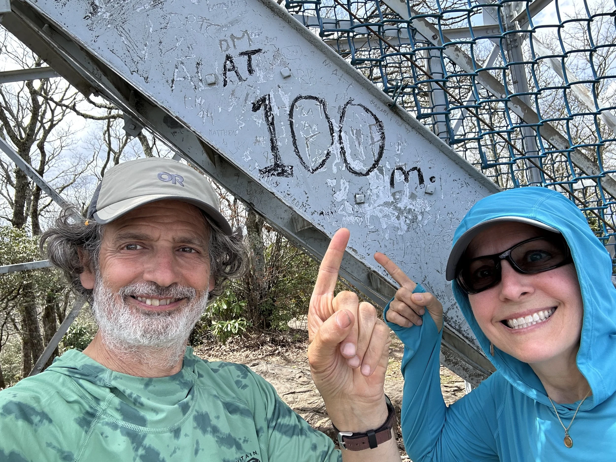
We are 268.1 miles into our hike per AWOL’s guide. We have walked a few more miles than that, for sure, with side trips to lookouts, or even just around town to get food.

We planned a Zero for Hot Springs because I was feeling so beat up in the Smokies. The Smokies were very rugged, water was scarce so we often ended up carrying extra water weight, and camping was a challenge since you are only allowed to camp at certain places.

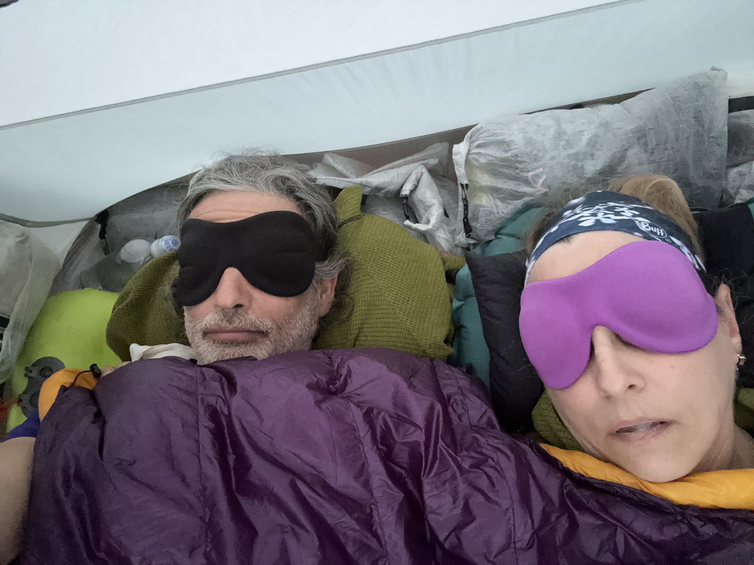
One night, we slept in the actual shelter which was not very restful. The other nights, we tented, but there were no good tent sites at any of the shelters. Since Covid, there IS the option to tent to social distance, and we are glad for that, but, seriously, there are no good tent sites.

Coming out of the Smokies the last day, I tweaked my right ankle. I am pretty sure it is tendon or muscle related. It also happens to be nearby the giant blister that will not heal these past few weeks.

Also coming out of the Smokies, we were greeted by lovely trail magic thanks to two REI employees from Knoxsville.

Next, we made our way to Standing Bear Hostel to retrieve a package. SB is an AT icon, and folks either love it or hate it. SB was gearing up for a pre-Earth Day celebration with a pot luck and music. We had made plans to have a shuttle driver pick us up instead, and we went to their home to camp on the lawn. Our stay included a hot outdoor shower and porto-potty, and a ride back to the trail. We heard later that the rumor was that SB was having a norovirus outbreak, and we were smugly patting ourselves on the back for not staying there.

Back on trail, with bad weather forecasted overnight, we pushed to get over Max Patch and on to a shelter beyond. Just as I was flagging, and really needed a break, we came upon trail magic hosted by a 2016 thru-hiker and his BIL. Perfect timing! We each had sodas and snacks and were revived to cover a few more miles

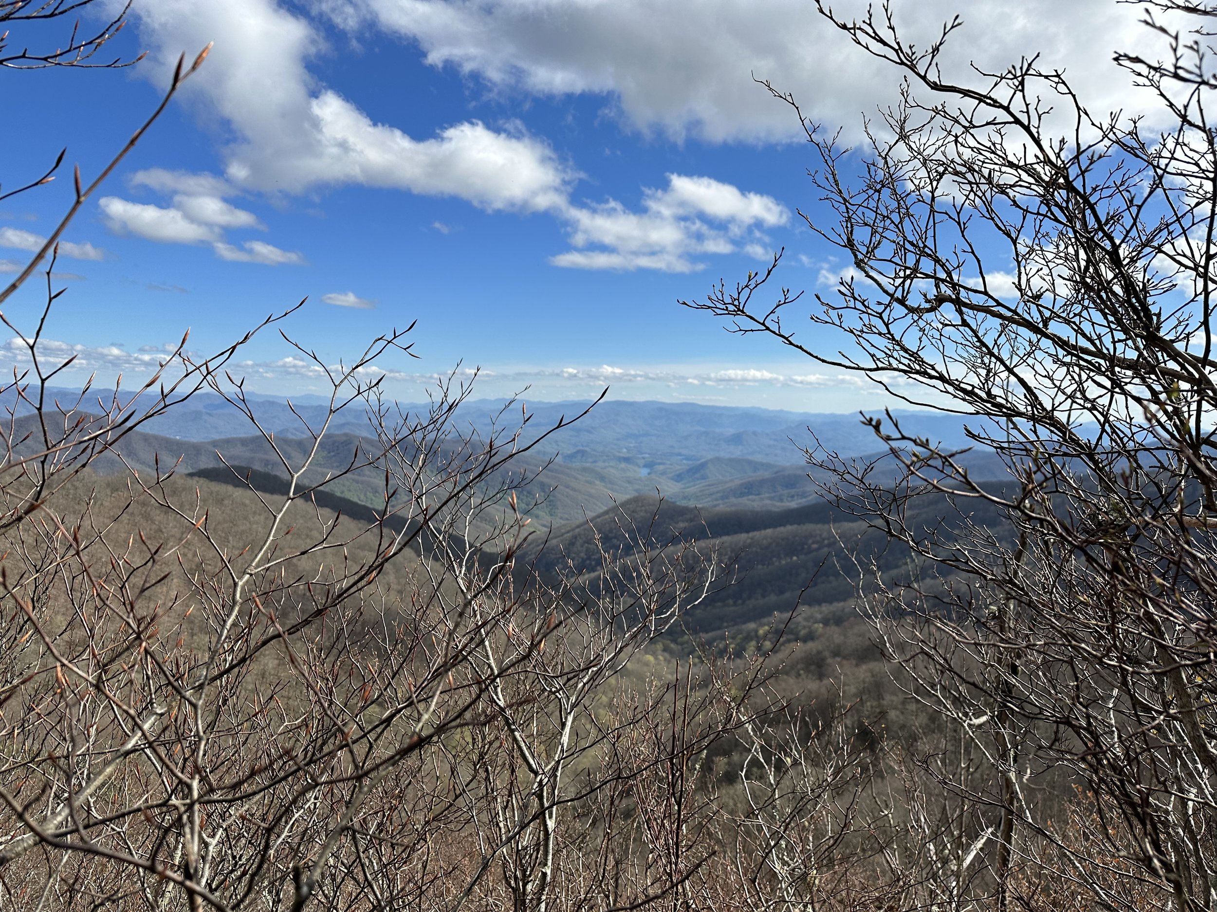
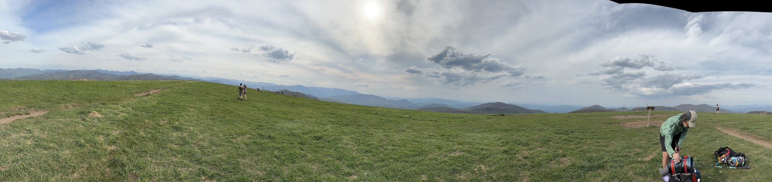
Max Patch was stunning with 360-degree views of mountains stacked upon mountains.

We pushed on to the shelter, found a small but proper tent pad, and set up camp. We took our suppers to the shelter table to be social, and caught up with our hiking friends, some of whom had stayed at SB, and had also partaken in trail magic just before Max Patch.

We woke to stormy cold weather.

We packed up, and took our breakfast to the shelter table again.

When we hiked, we were “warm” so long as we kept moving. We aimed to cover between 8.5 to 11 miles, knowing there were camp spots along our way toward Hot Springs. Water was plentiful, as we crossed many streams—such a change from the week in the Smokies.

We even stopped for a quick snack at a shelter, but I was so cold, I just wanted to keep moving after switching into a drier inside layer.

The hills we were climbing were smaller than previous days, but to me, they seemed to go on forever!

At the top of Bluff Mountain, I asked Charles to phone a hostel that could pick us up at Garenflo Gap because the promised sunshine was not seeming very promising. He got thru, they had a room, so we had a new plan to sleep indoors. It was almost enough to revive me.

Sunshine met us a few hours later and took us to the Happy Gnomad Hiker House. We got to have hot showers, loaner clothes, laundry, and food. Oddly, I felt so tired! I kept thinking how great it was going to be to get into Hot Springs the next day, and have a zero the day after that.

About midnight, I woke up and vomited.

Aha! An explanation for why I had been feeling so wrung out all day.

It’s probably norovirus.

Who knows where I picked it up? Either by eating from an open bag of chips (I even thought at the time bad idea) or at the shelter where many had spent the previous nght at SB from the table or from the privy. Gross, right?

I stayed in our room at the hiker house while the other hikers were there, and the bathroom closest to us was made available for my sole use. Charles wore his facemask any time he had to leave our room. We were able to stay late enough into the day that when we got our ride into Hot Springs, our accomodations there would be ready.

Jumanji took us to town; we were all of us masked up in his car. Happily, our room was ready even 30 minutes early; and I was able to extend our stay, so hoping plenty of time to recover, not just from tired and blisters,, but now also norovirus and a strained heel/ankle.

We are happy to be in a litttle apartment over a little bodega, next to the outfitter in town. Everything is within walking distance. We are masking when we go inside any place. We sure don’t want to spread whatever I am ailing from.

Yesterday, Charles ran into one of our hiking friends who told us he and 10 of the folks in his circle are sick, probably with norovirus. I am lucky that I only had the one huge vomiting episode and no diarrhea.

Today, I am feeling some better than yesterday, but the day has still heen punctuated by many naps, and my appetite is not up to snuff. Surely tomorrow will be even better than today.

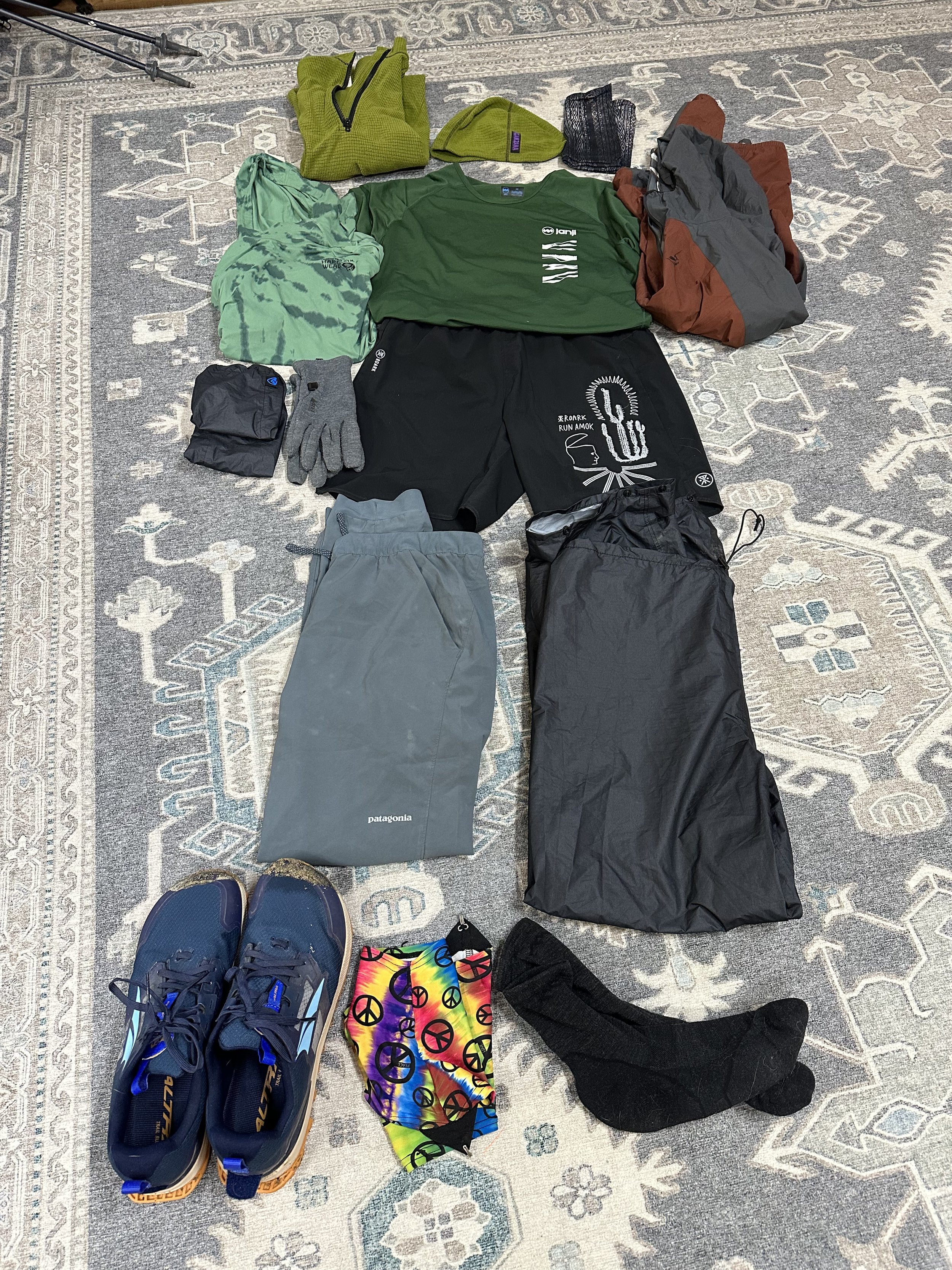
In a few days, we hope to get back on trail in the form of a slackpack to try out my blister-healing and whatever is going on with my heel/ankle.

Charles is a good sport, running our errands while I nap or ice my foot.

We are anxious to continue our journey, and know that sometines the body insists on rest one way or another.

Max Patch vista

200!

Two hundred miles behind us. Two thousand to go…

Clingmans Dome, highest point on the AT and the official 200 mile marker from Springer Mtn.

So you might wonder what happens when a couple of tired and wet hikers walk out of the woods into one of the most visited tourist sites in the Smokey Mountains. First you get some odd looks, then someone asks how far you have walked to get there. Tell them in a matter of fact tone that you walked 200 miles and they get very curious. Then tell them that you are walking to Maine and have 2000 more miles to go and they want to know EVERYTHING about it. We had a great chat with several very curious groups of visitors.

After chatting for a bit, we were trying to decide how much further we wanted to hike when a fella walks up and asks if we want a ride to town. In unison we said yes and 45 minutes later we were in Gatlinburg with no room or plan. Ian, our generous driver had ulterior motives as we discovered. He is planning a through hike in 2 years and wanted to pick our brains during the drive. So, we are now very well fed and preparing for our first “slack pack” of our trek tomorrow. We plan to hike 7.7 miles with just a lunch and a bottle of water before hitting the trail with full packs for the final bit of the Smokies on Tuesday.

Of course the weather doesn’t always cooperate. So despite the fog, before leaving we walked to the top of the observation tower and took a selfie to commemorate the moment.

Celebrating 200 miles on the AT at Clingmans Dome observation tower.

Day 22 is for Zero/Nero

Day 22

We hiked into Fontana yesterday, covering 8.5 miles from Cody Gap, arriving about 1pm. We figured out where the marina shop was, and got sodas and snacks. We chatted with Allesandra from Quebec in the shop, then saw Nick and Holly (Shadow) in the deck having beer, so joined them for a bit.

Soon it was time to hike up the hill, retrieve our backpacks hidden behind road blocks, and call for a shuttle up to the Fontana Village Lodge.

The shuttle driver took the curves up the mountain like we were in a road race. Eke!

We got checked into our room, and then headed to the Wildwood Grill for a late lunch. We saw some of our hiking friends, Little Monkey, Pantry, Hiking Viking ( he says it Wiking bc he's German and doesn't know his W's from his V's), and Nightwing ( who does know the difference).

They told us that the grits we had recommended a couple morning before were awful, and that they'd never trust our dining advice, or any advice, in future.

This morning, we saw them again at a different dining hall, and exclaimed over and over that the grits we were enjoying were spectacular, which they were.

We are taking a zero today. We might rake a double-zero if we can work it out. The lodge is full, and they are telling us there is no room for us for a third night. We might have to take ourselves down to the Fontana Hilton (that's a camping shelter) to zero a second day.

And we might not actually zero today after all. As I type, Charles is handling our laundry chores while I use my bear canister as a foam roller and tend to a blister that keeps filling on my left big toe, a present from my feet softening in the rain the other day. We may slack-pack our selves in the following clever way.

We can leave our big packs in the hotel, take the shuttle to where we were picked up yesterday, walk with just water about 3.5 miles to the dam, get a shuttle back to the lodge, and voila! Slack-pack done, and a few miles covered! When ready to get back on trail, we get a shuttle to the dam!

We are thrilled to have more than 160 miles done--just over 2000 more to go! Our next milestone will be at Clingman's Dome in the Smokies, which will mark 200 miles.

Update: Yes we did, we did a slackpack and covered two whole miles! We’ll be back on trail tomorrow for a short’ish day of hiking and get into the Smokies at last!

Hike vs Journey

One of the questions I always ask if the hikers we meet is “what motivated you to hike the AT?” Every answer is different but I see two main themes in the answers. Either they needed a clean break in their life or hiking the AT has been a long simmering goal. It has gotten me thinking about the difference between a long hike and the “journey” of self discovery we are all on. Recently talking to a young hiker around a campfire, I proposed that it was totally fine to leave the trail if you found/received what you were searching for before completing the hike. After all, the AT is just a very long hike NOT the journey itself.

Charles and Ruth Anne (Blaze) on a bench at the N O C.

Whew, that was a hard 15 miles! Waiting for a shuttle at the NOC after crossing Wesser Bald.

In Bryson City

We left Franklin on Wednesday and hiked 12+ miles, ending up at Lick Log Gap to camp. We had planned a stopped a mile’ish back, but the lack of good tent sites and some pot-smoking around the fire pushed us on. We had the gap to ourselves and had a very quiet night.

Rain started up just before our alarm went off. We have gotten really good at packing backpacks and taking down our tent in the rain, and we even surpassed our expectations on this particular morning. Part of our ease was that Charles dug our cat-holes the evening before, so that morning ritual was easier, too!

We normally pack up and head down trail for an hour before having breakfast since the process of heating water for coffee is rather loud, and as we are usually the first out of camp. But this morning, with no one around, we had coffee and hot breakfast as soon as backpacks were packed, and sat under our rainfly.

All that taken care of, we were ready to step onto trail. Just then, our friend, Strange Bird, sauntered past. Strange Bird is a large man who hikes with a specially-made tail that switches as he steps, and he wears a red hardhat with horns attached. The purpose of his outfit is to create smiles. Once you get past your initial shock and fear of the “weirdo” on trail, you will find yourself smiling. Strange Bird is also one of the fastest hikers I know. He goes fast, crashes for a bit, then continues speedily on. We’ll be following fast on his heels, and then, poof, he is gone, as if he has dis-apparated, ala Harry Potter. Amazing.

The day rained and rained.

We were passed by Bluebird, who we’d lost touch with, and her gang. She said they were getting off at Tellico Gap due to the “waterfalls in her shoes”, and while we aimed to go eight more miles to the NOC, getting off trail for the night into a dry motel seemed like a solid plan.

We got to Tellico Gap a couple hours later and had cell signal, so got a room at the Sleep Inn in Bryson City. Next, we needed a shuttle driver to pick us up at NOC and take us the 13 miles to the motel. It took a few tries and about 45 minutes sitting at the gap in the rain, but we eventually got that settled.

Now to hike the eight miles in less than 6 hours. No biggie, right? Except for the rain and terrain…

From Tellico Gap to NOC, most of the terrain is not too bad. There is a fairly steep section to get up to Wesser Bald where there is a tower, and if you’re hiking the AT, the path will take you up the steep parts. We skipped the side trail to the tower since we were socked in with fog and rain, so nothing worth walking a few extra feet to see.

The “fun” begins on the hike down. The trail goes along a ridge for literal miles. At some points, there are challenging rock “steps” to navigate while wearing your heavy rain-soaked pack and no side rails. Me? I kept reminding myself that we had a dry king bed with a flush toilet waiting at the end of this day. I’ll admit that I had quite a few “WTF?” bursts from my potty-mouth as these “challenges” kept coming. In truth, there were only 6-8 of them, each worse than the one before, so maybe I was getting a little shell-shocked. Even when the trail was no longer a ridge and the flora clearly changed, I was half-expecting another death-defying rock scramble to have to get down.

To keep it “fun”, there had been a big windstorm in the past week. There were so many blowdowns across the trail that I lost count. We’d be walking along the typical skinny trail barely carved into the side of a slope and come around a curve to be faced with the top of a tree blocking the path. At least one of these I know I could not have navigated thru without my trusted Charles. And, it was raining. I am not sure how my trail friend, Fortune Cookie, did it on her own (I am pretty sure she is ahead of us).

We did finally get to NOC, a 15+ mile day, got our ride to the Sleep Inn in Bryson City, got out of our soaked attire, ate a hiker meal for supper, and climbed into the king bed with dry sheets!

Feeling more beat up than usual, we have opted for our first zero. Not a bad option in light of the continued rain and chilly (40’s) temps.

We plan to head out into sunny 50’s tomorrow, slow our pace a tiny bit, and take three days to get to Fontana Dam and take another zero before tackling the Smokies.

Strange Bird

50 Miles, All smiles!

Today we passed 50 miles of hiking and we are still all (well mostly) smiles. We are sticking to our plan to take it easy at the beginning and it seems to be paying off. At Neel’s Gap we said goodbye to the younger faster members of our initial tramily. We might see them along the way if they take a zero or two. Now for a picture or two:

Breakfast at Sunrise on Cow Mountain.

Lunch just past Hog Pen Gap. Ruth Anne carried a Coke all day so we could split it at lunch!

Everything is in walking distance…if you have the time.

We have hiked 40.1 miles (31.1 on the AT) and had our first meal and bed in town last night. Hiking a short bit today as we take care of some bookkeeping chores this morning. On our first day, we met a man out for a day hike on the approach trail who passed along the wisdom “everything is in walking distance if you have the time”. It has stuck with me since. You could amend that to say if you MAKE the time! Now for a lunch picture:

Lunch on the AT somewhere around Woody Gap. So far the vistas have been spectacular but a bit chilly to sit and enjoy a meal.

Almost Time to Hike!

Today was fun. We drove out from Asheville to Atlanta. Along the way, we stopped at the NOC, picked up our hiker tags at Amicalola Falls and listened to the LNT talk, checked into the Embassy Suites, returned our rental car, rode the MARTA, participated in Happy Hour at the hotel, and walked across a busy intersection to eat at La Madeleine for supper. A full day, for sure!

Tomorrow morning, our shuttle driver will pick us up to take us back to Amicalola to start our hike. Whew!

We are ready!

Listening to the LNT talk, the guy was advocating for the plan we have already decided is ours! We should have been awarded gold stars right then and there!

Not anything left to do tonight but take another shower, repack backpacks, and get some sleep. Somebody thought it’d be a great idea to eat chocolate cake last night. It was vegan chocolate cake, after all, so why not?!?! Well, chocolate late in the day leads to sleeplessness, in our family. Not a great last night in Asheville. Tonight is a new night. No chocolate in sight! Hoping for blissful dreams and good hiking weather tomorrow!

We are hikers #1489 and 1490!

Easing/Eating Into Our Trek

We never seriously considered flying to Atlanta to start our hike. Not when we could take a few days to transition from the real world to the trail and visit some of our favorite restaurants along the way! So, here are some highlights!

Irish stew at The Great Sage in Clarksville, MD was our first food destination

Lunch at The Laughing Seed in Asheville, NC. They had a refreshing mescal cocktail and fantastic salads!

Dinner at Plant in Asheville, NC. The seitan tasted exactly like a chicken fried steak from Threadgills in Austin. Brought back some great memories!

So, tomorrow morning we mail our civies home and don our hiking clothes. We will pick up our hiker tags on the way to Atlanta to return the rental car. On Wednesday we have a shuttle lined up to take us to Amicalola Falls where we will begin our hike to Maine. Join me for lunch along the trail!

An Unexpected Treat

After the stress of getting on the road was behind us and we were on our way into Boston for lunch it occurred to us that Eileen was still in Boston visiting friends and might have time for a quick visit. Sure enough, she was at the VRBO packing her bags and was glad to have us swing by. We had a short visit, exchanged treats and got hugs all around. What a great unplanned treat to start us off on the right foot!

A visit with Eileen in Boston

A quick visit with Eileen in Boston!

We Are Off!

Our wonderful house sitters, Frank and Kerstin, arrived Tuesday! Yay! Lyla has taken to them extremely well, so we felt very little trepidation in leaving the house and our pets in their capable hands.

We drove through Boston south, and then, due to absurd GPS input, ended up at the edges of NYC. Boston was crazy busy, being a Friday and also Saint Patrick’s Day. Boston loves St. Paddy’s Day. We hit NYC rush-hour traffic, too. So. Much. Fun. NOT!

We constantly reminded each other that part of the beauty of our long trek will be not having to drive in big cities for quite some time. The universe was perhaps reminding us to look forward to the many gifts that we will find on the trail, not the least of which is no car traffic. Ha!

Crossing the Hudson on the George Washington Bridge

The fear in the pack

We are getting very close to striking out on this big adventure. I have found myself looking on Facebook at the other folks planning to hike the AT this year. It looks like nearly everyone has the need to post the contents of their pack for the world to see and comment on. And some of those comments are not at all kind or helpful.

When I take the time to really study the contents of a fellow hikers pack it occurs to me that I am being given the privilege of seeing their fears. Once you look past the tent, sleeping bag and pack everything becomes more or less optional and our fears drive what we choose to put in our pack. Some are easy to spot, say 2 canisters of bear spray. Some make you laugh, say waterproof socks AND waterproof boot covers. My pack in 2013 had 20 lbs of fear in it. Too much food, too many clothes, too much first aid and spares of everything I deemed critical.

So, when I stepped back to look for the fears in my pack this week it took a moment to spot. It is still my fear of being cold. I’m from Texas where the down puffy comes out and the car seat warmers go on whenever the temperature falls below 40 degrees. But we live in New Hampshire now where I find myself in my tee shirt shoveling snow when it’s 22 degrees! When we set out to hike the AT in 2013 I had long johns, long pants, long sleeve shirt, down jacket and Gore Tex shell, Thinsulate gloves, wool cap and I was still cold when the temps fell into the teens. So this winter, in preparation for this hike I set out to assemble a light weight and compact layering system that would keep me warm down to 15 degrees. I also wanted sun protection AND mosquito protection for the summer.

The clothes in my pack. Running shirt and shorts. Long pants and long sleeve sun shirt. Rain pants and jacket. Warm sweater, hat, gloves, socks and shoes.

The full layering system for cold weather, hot weather, sunny days, rainy days and mosquito season.

So there it is. On the warmest days I will hike with a pair of running shorts and a running shirt. For cool days I might add the long pants and/or my long sleeve sun shirt. When it starts getting cold I’ll add the Melanzana sweater and hat, and my wool REI glove liners. Windy and cold calls for the Zpack’s rain pants and waterproof mits and the super lightweight Outdoor Vital’s rain jacket. I carry a buff in case my neck or face get cold. The shoes, socks and gators are the same year round.

Charles and Ruth Anne in hiking gear in front of our house with tall snow bank.

Heading out for a 3 mile walk after 14” of snow. Temp was 30 and winds were 30. But the sun was shining!

Today was a good test of the coldest we will likely encounter on the trail. 30 degrees with 30 mph winds. I was not only warm, I was almost tempted to remove a layer after about 20 minutes of walking. The whole system weighs in at just over 2 lbs and packs into a bag the size of a cantaloupe. And it is comfortable to wear while hiking.

So, the next time you set out on an adventure take a moment to see how much fear you are carrying in your pack/trunk/suitcase/purse/guitar case/cargo shorts. And then set out to acknowledge and confront your fear. You never know how much of the excess weight you are carrying can be left behind!

And a Map!

What is this trail that we will be hiking? The Appalachian Trail, AKA the AT!

We will be hiking NOBO, or northbound. Our intent is to hike the whole way going north to Katahdin in Baxter State Park in Maine. Being “older” hikers (yes, we will be 60 and 59 while hiking), we will keep track of where we are and how likely we will be to finish our trek before snow sets in a Mount Katahdin gets closed for the thru-hiking season.

What?! You mean you could hike all that way and be turned back before finishing?

You betcha!

What does that mean? Initially, it means nothing. However, by the time we reach the “halfway point”, Harpers Ferry, we will need to evaluate how we are covering the distance, and decide if we will keep heading north, or flip up to Katahdin and hike south.

That would be known as a Flip-flop. A flip-flop just means that at some point in your hike, you change hiking direction. I think there is even something known as a Leap-frog where the hiker skips up to a point farther north (if NOBO), hikes some, then comes back to finished what was skipped.

SOBO would be if we were hiking southbound from Katahdin. Those folks typically start around the beginning of June, depending on when ice and snow are melted enough to be safe ascending Katahdin to start.

And you know what? Those 2198.4 miles that make up the Appalachian Trail do not count the additional 5 miles you must hike down Katahdin to finish. Or start. Nor do the miles you will hike into town, out of town, to the grocery, side trails for vistas, views and water, etc., count toward your total. But who’s counting. Not me…not really. I don’t really want to hike extra miles just for sh*ts-and-giggles, but I DO want to enjoy the experience while out there. Who knows if I will ever make it back to a spot to see a vista, so I’d better make choices and see what I want to see in the moment.

The Appalachian Trail covers 14 states in the east of our great country. They are, in the order we will hike, Georgia, North Carolina and Tennessee (you hop back and forth between the two for a bit), Virginia, West Virginia, Maryland, Pennsylvania, New Jersey, New York, Connecticut, Massachusetts, Vermont, New Hampshire, and Maine.

I’m going to attempt to post a very cool interactive map below.

Well, it didn’t. I’ll see what needs doing…

Lemme try again! It’s not interactive, but that’s okie dokie. Click on the arrow in the upper right corner of the map to see the whole thing.

A map of the Appalachian Trail from the National Park Service

It’s a very neat map that shifts the state shapes in order to sorta straighten out the trail line. I have a poster of this hanging up at our house, and another AT poster with the states showing their proper shapes. I have a fantasy of being able to post “where” we are along this poster in future, but it may be too fancy for my limited web skills while hiking.

We’ll also be hiking with two Garmin InReach minis. We have the ability to post those locations online, so we’ll see how to make that interface with this blog page.

I’m hoping you’ll also visit our other blog page, www.LittleBitNosy.com. If I figure out how to embed web addresses, I will. (FWIW-I used to create and maintain web sites in a past life using Dreamweaver. I loved it. It was easy-peasy. Using this awesome SquareSpace site to host these blogs is requiring a learning curve for me. I “know” these blogs “should” be able to do “things”. It’s a matter of figuring out this particular system. It might be easier if I didn’t know what I know…)

So what’s the “big deal” about time for our hike and where we will be?

Typically, the park service will “close” Katahdin around the middle of October. People hike Katahdin in the snow, I know, but I do not plan to be one of them. And the park service does not want us up there as through hikers, I guess. We want to finish our ascent of Katahdin well before the closure date.

Our hike will commence March 23 and will continue till we finish, hopefully by the end of September.

What’ll we do if we decide we are “not gonna make it”? We’ll flip up or skip up, then cover what we lack to finish out our hike.

Do hikers HAVE to finish a thru-hike in a set period of time?

Yes! In order to be considered a “thru-hike”, you complete the trail in one calendar year. What that means is that starting March 23, 2023, we have until March 22, 2024, to complete a “thru-hike”. If we finish after March 22, 2024, it is no longer technically a “thru-hike”. The year deadline is a sort of challenge. I’d call that a technicality, too, but no need to worry about that at this point. We haven’t even started, yet. We’d still get “credit” for hiking the whole thing; it just might not be seen as a “thru-hike” by some people. Whatever.

We are going to hike and hike and hike some more. We are going to have an adventure! Epic!

Here’s my pack contents!

You gotta do it. You gotta take a photo of your backpack contents. It’s a rite of passage.

Yesterday, Charles and I each emptied our tidy backpacks and placed every item out for display for one another. Then we each showed the other what we had. We even traded an item or two.

Then we packed it all back into the backpacks.

Somehow, I ended up short a sack, and frantic emotions occurred. I still don’t know where I “lost” a bag, but it’s all back in there. It’s still hovering just below 20 pounds. My bear canister weighs about 6.5 pounds, and a quart of water will weigh about 2 pounds. All told, my pack will be 26-28 pounds. I was hoping for lighter, but it’s actually not too bad.

Charles’ backpack is coming in at about 32 pounds.

Re-packing!

Last week, I was pretty happy with how my backpack was coming together. The last few days, I have been mulling over all the stuff and extras I had in there.

This morning, after a walk wearing my pack, it weighed in at 20# 9oz—not too shabby. Sans water and food, of course.

After thinking on the clothes I had packed, I have decided to remove “extras”. I can always pick up something more on trail, if I feel I am lacking something, but I’d be sad to leave a favorite item in a hiker box because I am ONLY taking favorites. I weighed what I removed, and those items lost me 2# 2oz! Win!

Now it weighs 18 pounds!!!! Whoop whoop!

Disclaimer: That’s all my clothes, including what I’ll be wearing, but I have my gloves, jackets, and hats in the mudroom, so maybe add back another two pounds, but, dang! Happy dance!!!!